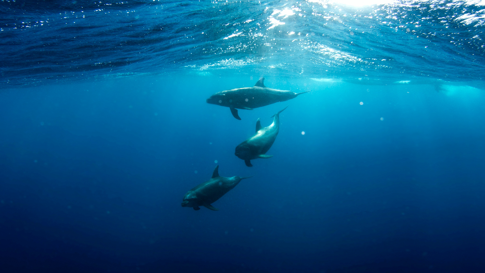
A few weeks ago, while discussing boat excursions from Genoa, we talked about the International Pelagos Sanctuary, the vast sanctuary for cetaceans located right there, in front of the berths of our tourist port of Genoa: it is no coincidence that the Marina Porto Antico is a privileged point for setting out by boat and quickly reaching the area where schools of tuna, dolphins, sunfish, and sperm whales move daily. But what makes this area of the Ligurian Sea so rich in life? There are many explanations, but one is certainly linked to the great depth that the sea reaches, especially – in the area in front of Genoa – in correspondence with the so-called submarine canyons of Genoa, long incisions along the seabed of the Ligurian Sea. To understand what we are talking about, it is enough to take a look at the satellite images on Google Maps; you will distinctly see two lines extending from Genoa towards the southwest. But how are the submarine canyons of Genoa formed, and how were they formed?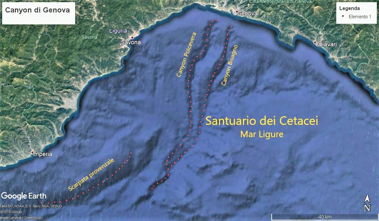 What are the submarine canyons of Genoa?
The Mediterranean hosts many submerged canyons. There are depressions and channels of this type along the French coasts, near Malta, but also along the coasts of Egypt and Lebanon. Of course, there are also submarine canyons in other parts of the world: in California, for example, there is a chasm 153 kilometers long, reaching a depth of 3,600 meters.
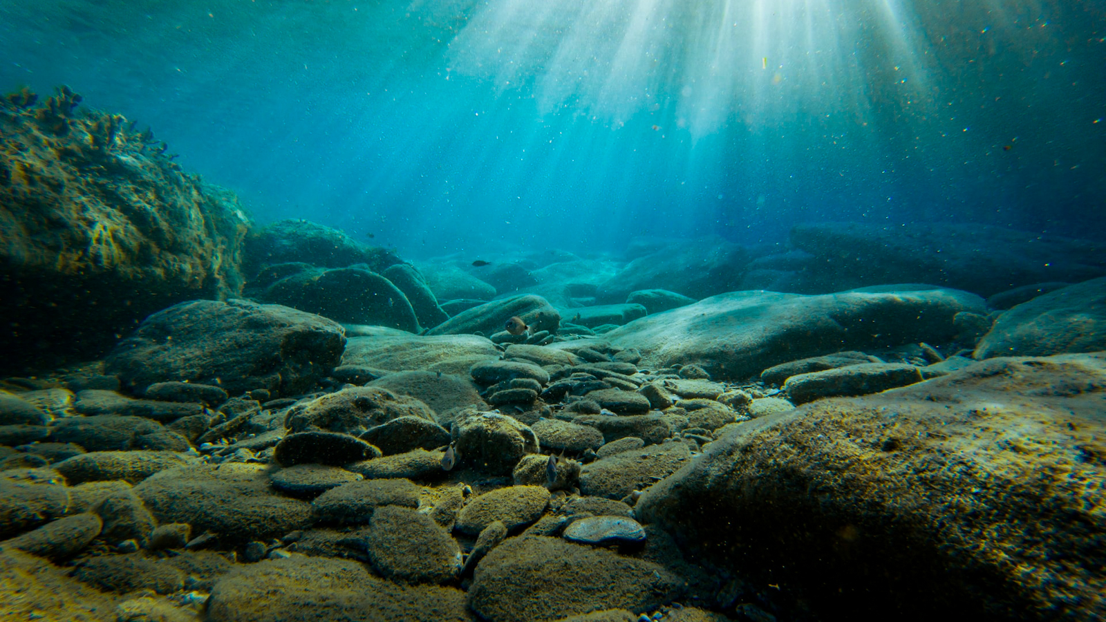
The submarine canyons of Genoa, in any case, are the deepest in the Mediterranean. These two enormous fissures carve the seabed for about 70 kilometers in length, reaching a depth of 2,400 meters. These are extremely narrow underwater “valleys,” with very steep walls: this is why they are referred to as canyons.
How were they formed
The question naturally arises: how were these canyons formed that seem to start right in front of our tourist port of Genoa? The culprits of this seabed erosion are the two largest streams of Genoa, namely the Bisagno and the Polcevera. It was the water running in the beds of these rivers that carved the ground, creating these deep depressions. We are obviously talking about a very distant era, namely the Messinian, more than 5 million years ago: at that time, the Mediterranean was dry due to the closure of the Strait of Gibraltar (it should be noted that the water balance of the Mediterranean Sea is generally negative, and this basin is as we know it thanks to the incoming Atlantic current). Thus, the two streams ran on otherwise dry land, eroding the soil, and eventually ended in what must have been a salt lake. Only after a period estimated at about 600,000 years did the Strait of Gibraltar reopen, with the sea covering, among other things, the “valleys” created by the Genoese streams, which must have been quite torrential at the time.
Not the only canyons of Genoa
Due to the great depth, the abyssal currents, and the abundance of food, whales, sharks, dolphins, and other magnificent marine animals inhabit the sea that lies in front of Genoa, in correspondence with its canyons.
Note: it should be mentioned that someone, when talking about the Ligurian canyons, might refer not so much to these underwater depressions, but rather to the canyons of Val Gargassa, a valley located a few kilometers from Genoa, in the Beigua Regional Natural Park. Here, there are real rocky canyons, with deep gorges, spires, rocky bastions, and so on.