Here are three anchorages to discover in the Eastern Ligurian Riviera accessible from Marina Porto Antico
July. It’s time to set sail and discover the Ligurian coast and its surprises. Here are three sheltered anchorages in the Eastern Riviera, between Genoa and La Spezia, easily accessible from Marina Porto Antico, one of the most convenient moorings in Liguria thanks to its services and central location.
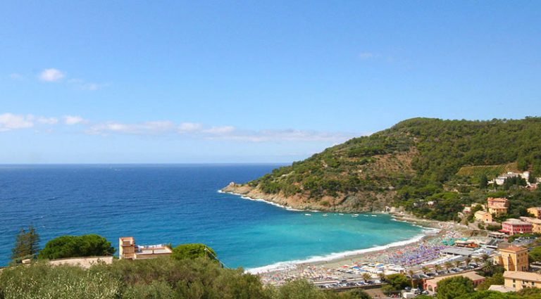
The anchorage of Riva Trigoso
44° 15′ 18″ N, 9° 25′ 21″ E
 The first is the anchorage of Riva Trigoso which is located in front of the town that became famous for the Fincantieri shipyards. Thanks to its position delimited by two promontories (Punta Baffe to the east and Punta Manara to the west), this inlet is sheltered from currents and winds, and boats can be moored from the coast up to Punta Manara.
Despite its history linked to shipbuilding, this district of Sestri Levante has maintained the characteristic and tranquil demeanor of the neighboring villages. Over the years, it has become a much-loved destination, especially because it is less crowded than the better-known Sestri Levante. Riva Trigoso is also well-known for bagnun, the typical dish of this Ligurian seaside village, made with anchovies, hardtack, and tomatoes.
The turquoise sea of Riva is highly appreciated by snorkeling enthusiasts, fishermen, and divers which requires constant attention. The seabed near the two points that mark the boundaries of the Gulf is rich in caves, and approximately three hundred meters offshore from Riva Trigoso, there are frequently visited shallow waters.
The anchorage of Bonassola
44° 10′ 51″ N, 9° 34′ 50″ E
 Proceeding towards La Spezia, another of the three anchorages in the Eastern Riviera accessible from Marina Porto Antico, absolutely not to be missed, is that of Bonassola, consisting of an inlet sheltered from winds and currents in front of which there is a free and equipped beach.
Although it does not offer particular facilities, the anchorage of Bonassola is accessible at all hours. Bonassola is a small seaside village surrounded by hills covered with maritime pines, terraces with olive trees and vineyards typical of the Ligurian landscape; a short distance from Levanto and the Cinque Terre, it is the ideal destination for those seeking a quiet and relaxing holiday. Bonassola is part of the Cinque Terre National Park, and there are many initiatives organized by the local tourist office; moreover, there is no shortage of hiking trails and bike paths: the Maremonti Cycle and Pedestrian Path passes through here, developing along the old disused railway line, connecting Framura to Levanto, between tunnels and nature.
The area is highly appreciated by scuba diving enthusiasts, as here lies the wreck of a ship sunk during World War II: it is the steamship Bolzaneto, which was torpedoed in front of Bonassola in June 1943. Today, the wreck is at a depth of about 54 meters inside the anchorage and is a destination for visits by groups of divers who come from all over Italy.
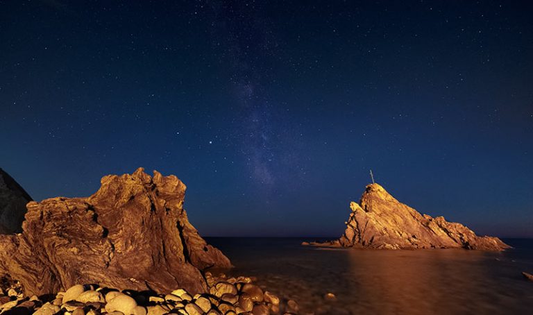
The anchorage of Terrizzo
44° 3′ 22″ N, 9° 50′ 32″ E
 Once you reach the Gulf of La Spezia, you can drop anchor in the anchorage of Terrizzo, the last of the three anchorages in the Eastern Riviera that we recommend: the landing is located between the coast and the island of Palmaria, which, together with the other islands of the La Spezia archipelago, protects it from the swells coming from the Southeast. Of the three islands in the Archipelago, Palmaria is the most frequented and well-known, especially for beach tourism, precisely because of the clarity of the waters that lap its shores.
South of Palmaria is the island of Tino, recognizable by its triangular and rocky shape, abundant with maritime pines.
Here is the military lighthouse, a fortified neoclassical construction that has undergone numerous changes over time. Finally, the island of Tinetto is the smallest of the island group of Porto Venere. It has an area of just over half a hectare, but it is an important reality in the panorama of biogeography and history.
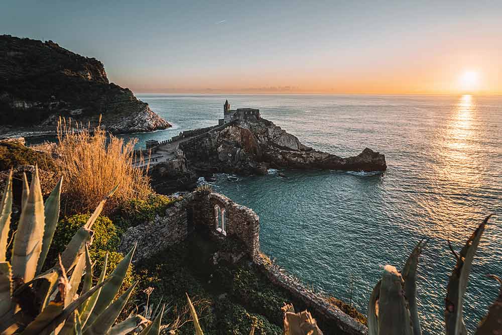
The seabed of the anchorage has manageable depths, ranging from 2 to 8 meters at varying distances from the coast. During maneuvers within the Terrizzo Anchorage, attention must be paid to the rows dedicated to mussel harvesting and fish farms. From this anchorage, you can enjoy a beautiful view of the bay and the romantic and ancient Church of San Pietro perched on the cliff overlooking the sea.
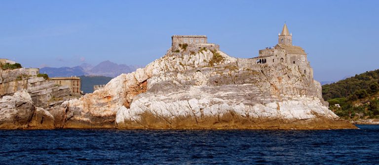
From a distance, it almost looks like a fortified castle with towers and walls, but in reality, it is a very ancient church consisting of two connected buildings: one in a more recent Gothic style and the other Romanesque, much older. Near the rocky spur below the church is the Arpaia cave, also known as Byron’s cave, where the famous English poet drew inspiration for his literary works.
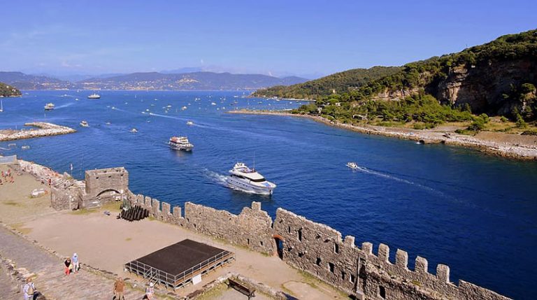
On land, it’s worth taking a walk to discover the narrow streets of the historic center of Portovenere. The entrance, characterized by ancient houses and narrow streets, was built in 1113, while the nearby tower dates back to 1161. On a rocky height stands the Doria Castle, which belonged to the Doria family that played a crucial role in the history of the Republic of Genoa. From here, you can enjoy a splendid view of the city and the church of San Pietro.
The proximity of the Cinque Terre National Park and the Portovenere Regional Natural Park offers boaters the possibility of countless hiking excursions along the nature trails within the two parks.
All that’s left is for you to cast off and set sail to discover the wonderful coasts of the Ligurian Sea and its shores!